


GPS Map Cam: Phone Tracker
4.223.00 Reviews
App Specs
- Version
- 1.0.4_20251022
- Updated On
- License
- Free
- Downloads
- 5,000,000+
- Developer
- GONG INTERNATIONAL AGENCY PTE LTD
- Categories
- Maps & Navigation
- Platform
- Android
Screenshots

 Analysis by AppCompare
I judge a location-photo app by a practical question: will it help me remember where a picture was taken without making the act of taking it feel like a chore? GPS Map Cam: Phone Tracker brings photo stamping and a family-location angle together, so it is aimed at people who want place details attached to memories as well as a way to view locations for their circle. That combination makes it more specific than a standard camera, but it also means it may not be the right fit if you only want directions or a simple photo editor.
What I would decide before installing
My first decision would be whether I want location information visible on the image itself, rather than only saved as photo metadata or remembered in a separate map app. A visible stamp is useful when a picture needs to explain its setting at a glance, but it can also make a photo busier and expose more location detail than I want to share. I would start with a restrained stamp style and decide, image by image, whether the coordinates or other context belongs in a version I plan to post.
I would also separate the app’s two jobs in my mind. The camera side is for recording a place with a photo; the family locator side is for checking where people in a circle are. They can complement each other on a trip, but they solve different problems and deserve different privacy expectations. I would only use location sharing with people who understand what is being shared and have agreed to it, rather than treating it as a casual add-on to taking pictures.
On Android, the app is free to install, is rated for Everyone, and is developed by GONG INTERNATIONAL AGENCY PTE LTD. Its average is 4.2 from around 5,200 ratings, and it has passed over a million installs. Those figures suggest it has found an audience, but they don’t tell me whether its particular balance of camera tools and location features suits my habits. I would treat them as context, then judge the app by whether the workflow feels comfortable on my own phone.
Where GPS Map Cam fits in a map-and-camera routine
I find the most useful way to judge this app is to ask whether I want location context to shape the photo workflow, rather than simply live elsewhere in my camera roll. That distinction matters on ordinary outings: a picture can become a practical marker for a place I may need to find again, while the family-location side serves a separate coordination purpose. With that in mind, I’d next weigh where this combined approach helps and where a dedicated app is the cleaner choice.
Getting Started with Ease
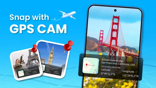
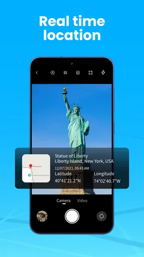
First things first, setting up the GPS Map Cam: Phone Tracker was a breeze. The interface is clean and intuitive, which is a huge win in my book. You know those apps that take forever to figure out? This isn’t one of them. A few taps, and you're good to go. The app's main function is to stamp your photos with GPS coordinates, so you always know exactly where a picture was taken.
Features That Stand Out
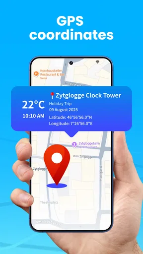
Let’s dive into the standout features, shall we? One of my favorite things about this app is the customization options for your photo stamps. You can choose what information you want to display: latitude, longitude, altitude, date, time, and even the weather. It’s pretty cool to look back and see not only where you were but what the day was like.
Worth Reading Before You Choose

EA SPORTS FC Mobile 26 Is a Bigger Football Game, but It Takes Time

Flipboard Shows What News Apps Must Do Beyond the Feed

Switching to Android Auto Means Rethinking Your Driving Routine

Google Calendar Makes a Crowded Week Easier to Manage

Ludo King Makes the Most of the Minutes Between Plans

Baby Panda World Brings Quick Play to Modern Phones, but Its Game Library Feels Busy
The app also supports various map types, including satellite and terrain views. This means you can get a visual feel for your location beyond just numbers. Plus, if you’re into sharing your photos on social media, these unique stamps add a bit of flair that your followers will love.
A workflow that suits more than vacations
I’d find the stamp options most useful when the image needs to serve as a record, not just a keepsake. For example, if I were checking a trail entrance, documenting a garden project, or revisiting a roadside viewpoint, a picture marked with the place and time would be easier to interpret later than a camera-roll image called something like “IMG.” A useful habit is to take one wide shot that shows the surroundings and, if necessary, a closer shot of the detail; the stamp gives both a shared location context without relying on my memory.
There is a small trade-off in that workflow: precise coordinates can be helpful to me and overly specific for a public post. I would keep a clean original for private reference and share a stamped copy only when the location detail is appropriate. If I am photographing a home, a child’s regular route, or another sensitive place, I would avoid publishing an image that exposes more than intended. That is not a reason to avoid geotagging altogether; it is a reason to choose the stamp content deliberately.
Navigation Made Simple
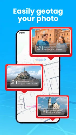
Another great feature is the integrated map view that allows you to navigate to previous photo locations. Whether you’re reliving a trip or just trying to remember a spot you stumbled upon, this function is incredibly handy. The app links seamlessly with your phone’s GPS, so accuracy isn’t an issue.
While using the app, I noticed that the battery consumption was surprisingly efficient. We all know GPS can be a battery drain, but the developers have done a solid job here. I was able to use it throughout a full day of sightseeing without needing to recharge my phone.
How I would use the family-location side
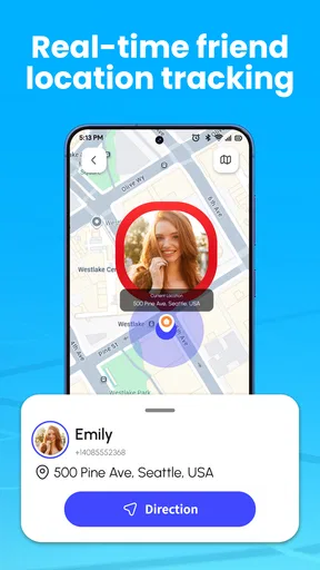
The circle-location feature makes the app more than a camera utility, but I would not confuse it with a dedicated navigation tool. On a family outing, I can see the value of checking where everyone is while using photos to mark meeting spots or places worth returning to. A realistic example is a busy day at a large outdoor venue: one person can take a stamped picture of a chosen meeting point, while the group uses its location circle to coordinate. That is more useful than sending a vague message like “near the entrance,” especially if there are several entrances.
For everyday use, I would keep the arrangement simple: agree on who is in the circle, when location checking is appropriate, and what to do if someone’s phone is unavailable. A locator is a convenience, not a substitute for a clear meeting plan or direct communication. I would also avoid assuming that a location dot is exact enough for a safety-critical decision; maps and GPS can be affected by surroundings and device conditions, so a quick call or a visible landmark may still be the better final check.
Where another kind of app may be better
Compared with a regular camera app, this one’s appeal is that location details and a map-oriented workflow sit close to the photo-taking experience. The usual camera is likely the simpler choice when I want the quickest shot, familiar controls, or images without a visible overlay. I would not switch away from a camera I already like just for occasional travel photos unless I genuinely expect to use the location stamps or revisit saved places.
It also occupies a different space from a conventional maps app. A maps app is the better pick when my main task is planning a route, finding a destination, or navigating turn by turn. GPS Map Cam is more compelling when the place itself is part of the photo record and I want to return to a photographed location. And if my main priority is keeping track of relatives, I would compare it with a dedicated family-location service based on the controls and routines my household needs, rather than assuming the camera features make it automatically superior.
A few practical trade-offs
Before a day out, I would check the stamp layout and choose which details I actually want visible. Coordinates are valuable for returning to a specific point; a date or time can help sort a sequence of pictures; weather context can make an old image easier to remember. But showing every available detail on every photo can turn a pleasing shot into a block of text. A quick test picture lets me see whether the overlay competes with the subject before I use it for a whole album.
I would also try the map view in the sort of area where I expect to use it, rather than relying on a single test at home. Satellite and terrain views offer different kinds of context, but neither guarantees that a spot will be obvious: a tree-covered trail, a newly changed street, or a featureless open area may still require a landmark or a note in the photo. That is a useful limit to remember if I am collecting images for later fieldwork or a return visit.
The app is free, with in-app purchases ranging from $3.99 to $26.99 per item. I would begin with the free experience and only consider paying if I run into a specific restriction that matters to my routine; there is little point in buying extras before knowing whether I use the map and stamp tools regularly. The current version is 1.0.4_20251022, and Android 7.0 or later is required. Since the version is relatively specific, I would check that my device’s software meets the minimum before planning to depend on it for a trip.
A Few Considerations
Now, no app is perfect, right? While GPS Map Cam: Phone Tracker is generally smooth sailing, I did encounter a slight lag when switching between different map views. It’s not a deal-breaker by any means, but something to be aware of if you’re quickly trying to toggle between options.
Also, keep in mind that while the app itself is free, there are in-app purchases available. If you want to unlock additional features or remove ads, you’ll need to shell out a few bucks. Personally, I found the free version to be more than adequate for my needs, but it’s always nice to have options.
Who I would recommend it to
I would put this on the shortlist for travelers who like a visual diary, people who revisit outdoor locations, and anyone who needs their photos to carry more context than the camera roll usually provides. It can also suit a family that wants a locator in the same app it uses to document outings, provided everyone is comfortable with that arrangement. The strongest case is not simply “I take lots of pictures”; it is “I often want to know exactly where this picture was made, or I want a convenient way to find that place again.”
I would skip it if I rarely revisit locations, dislike text over photographs, or mainly need dependable route guidance. I would also choose a separate camera and locator if combining those roles feels confusing or if different people in my household need different privacy controls. That split may mean a little more app switching, but it can be a better fit when each task matters more than having both in one place.
Final Thoughts
So, is GPS Map Cam: Phone Tracker worth the download? In my opinion, absolutely. It’s a fun and functional tool that enhances your photo-taking experience, particularly if you’re an avid traveler or just someone who loves documenting life’s little adventures. The ability to look back and not only see but pinpoint where you’ve been adds a whole new layer to photo albums.
Whether you’re using it for personal memories or professional documentation, this app is a great addition to your smartphone arsenal. So go ahead, give it a try, and start capturing your world with precision.
Pros
- Accurate location tracking with minimal lag.
- User-friendly interface for easy navigation.
- Offline maps available for no-internet zones.
- Customizable notifications for location updates.
- Seamless integration with social media sharing.
Cons
- Consumes battery quickly during active use.
- Requires high storage for offline maps.
- In-app ads can be intrusive at times.
- Limited features in the free version.
- Occasional glitches in remote areas.
FAQs for GPS Map Cam: Phone Tracker
What features does GPS Map Cam: Phone Tracker offer?
GPS Map Cam: Phone Tracker provides users with real-time location tracking, geotagged photos, and a detailed history of visited locations. It also includes features like speed tracking and route mapping, making it ideal for personal use or managing a fleet. The app ensures precision and offers easy sharing options for location data.
Is GPS Map Cam: Phone Tracker accurate and reliable?
Yes, GPS Map Cam: Phone Tracker is designed to provide highly accurate and reliable location data. It uses advanced GPS technology to track positions in real-time. However, the app’s accuracy can be affected by factors like signal strength, weather conditions, and the environment, such as urban areas with tall buildings.
Does GPS Map Cam: Phone Tracker require an internet connection to work?
The app requires an internet connection for real-time tracking and data synchronization. However, basic GPS functionality may work offline, allowing you to view your current location. For full functionality, including geotagged photo uploads and remote location sharing, an active internet connection is necessary.
Is my data secure when using GPS Map Cam: Phone Tracker?
Your data security is a top priority for GPS Map Cam: Phone Tracker. The app uses encryption to protect your location and personal data. Additionally, it adheres to strict privacy policies, ensuring that your information is not shared with third parties without your consent. Regular updates enhance security features.
Can GPS Map Cam: Phone Tracker be used internationally?
Yes, GPS Map Cam: Phone Tracker can be used internationally. It supports GPS tracking in any location around the world. However, be mindful of potential roaming charges if using mobile data abroad. Always check with your mobile carrier regarding international data usage policies to avoid unexpected fees.


